In managing distribution networks, Arcoda’s 3D Photo Survey is a valuable tool for multiple applications. One of these is the automatic processing of ultra-high-detail orthophotos of areas of interest. With this feature, you can effortlessly obtain images so detailed that they can be used for precise measurements and network mapping via your GIS – all without leaving the office.
This is just one of the applications made possible by this technology. If you want to learn more about all the other applications of 3D Photo Survey and how it works, please visit our website:
Discover a new way to obtain precision 3D models of your network infrastructure and highly detailed orthophotos! With 3D Photo Survey you can generate three-dimensional models of your networks directly from your smartphone—with stunning results! The models produced by 3D Photo Survey are realistic, precise, already georeferenced, and oriented.
What are the applications of 3D Photo Survey?
The use cases for this technology are numerous.
3D Photo Survey – Expeditious excavation survey
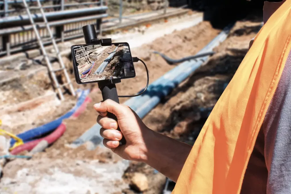
Innovation for utilities is taking giant leaps! With 3D Photo Survey you can survey excavations in a fast and easy way. How?
Launch the 3D Photo Survey app, follow the instructions, and capture images of the excavation site. The images are sent to the server, which processes them to automatically generate a precise and realistic 3D model of the utility excavation—perfectly georeferenced and oriented.
3D Photo Survey – Virtual surveys from the office and final reports
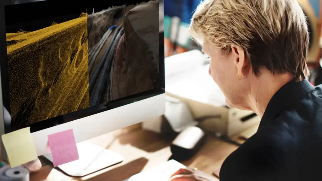
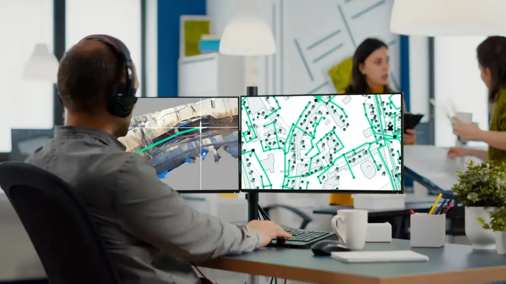
With 3D Photo Survey you can inspect network infrastructure without leaving the office. How? The 3D models of underground infrastructure captured via smartphone during excavation and installation phases are automatically uploaded to your corporate GIS. This allows back-office teams to work independently, eliminating the need for onsite personnel. From their desks, they can conduct virtual surveys, explore the network, and perform precision measurements directly on the digital models. Remote access to all geometric data is also ideal for digital work reporting!
Empower your back office, save time, reduce costs, and minimize fieldwork. Choose innovation with Arcoda Next.
3D Photo Survey to make surveys of your underground infrastructure in AR
One of the many uses of 3D Photo Survey is conducting augmented reality surveys of underground infrastructure and their precise relocalisation. When the excavations is closed, visualizing holograms of infrastructure buried beneath the road surface allows operators to work safely and accurately. Choose to work smarter!
How does it work? Using a smartphone paired with a high-precision GPS, holograms of underground infrastructure are overlaid precisely onto the road surface, visually guiding operators during interventions. This reduces the risk of damaging or breaking the network, avoiding service interruptions. Safety also improves: acting on precise, reliable information minimizes risks for operators!
3D Photo Survey to map your network
With 3D Photo Survey you can easily create 3D models of your networks. Discover how simple it is: all you need is a smartphone paired with a high-precision GPS!
These realistic, precise models—already georeferenced and oriented—have multiple uses. For example, from the comfort of your office, you can effortlessly map your networks in GIS. And this is just one of the applications made possible by this technology.
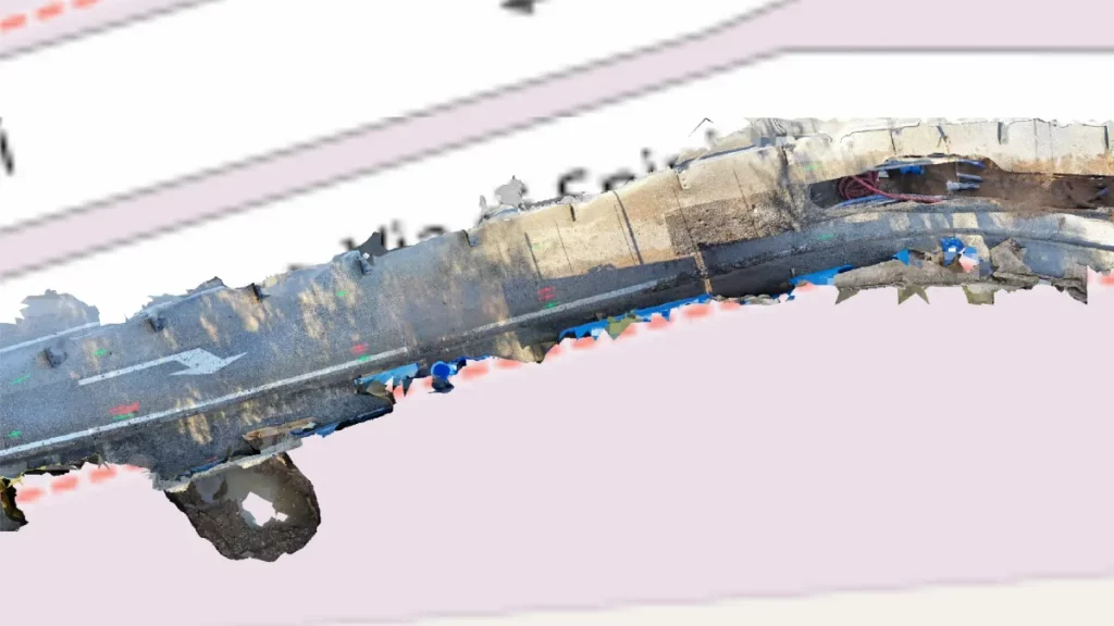
3D Photo Survey to generate ultra-high-detail orthophotos
In managing distribution networks, Arcoda’s 3D Photo Survey is a valuable tool for multiple applications. One of these is the automatic processing of ultra-high-detail orthophotos of areas of interest. With this feature, you can effortlessly obtain images so detailed that they can be used for precise measurements and network mapping via your GIS—all without leaving the office.
3D Photo Survey to report restorations
3D Photo Survey is ideal for various uses in distribution network management. One key application is easily obtaining precise, objective measurements of road pavement rehabilitations after underground operations. These measurements are captured from the office by analyzing the high-accuracy 3D models acquired via 3D Photo Survey.
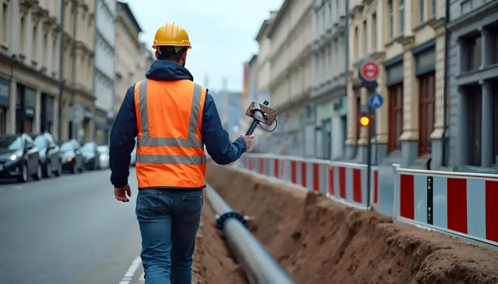
Excavation and network installation: supply of map to operators
With 3D Photo Survey, you streamline excavation and network installation. From the comfort of your office, you can generate maps to provide to the teams in charge of the operations.
3D models serve multiple purposes, supporting both back-office activities (providing all digital geometric data) and field operations. After backfilling, field workers can even use augmented reality on their smartphones paired with a precision GPS to relocalise underground infrastructure.
Additionally, conducting multiple surveys over time creates a series of models, enabling step-by-step analysis of work progress (e.g., displacements objects) and documenting hidden or relocalised elements compared to the initial state.
3D Photo Survey to upload corporate GIS
Among the many benefits of using 3D Photo Survey in managing distribution networks is the simplified maintenance of corporate data related to your infrastructure. The 3D models of network infrastructure continuously feed into your corporate database. Since they’re fully georeferenced, these models enable you to keep your GIS updated with the real location of assets!
With 3D Photo Survey you can easily create 3D models of your networks. Discover how simple it is: all you need is a smartphone paired with a high-precision GPS!
These realistic, precise models —already georeferenced and oriented— have multiple uses. For example, from the comfort of your office, you can effortlessly map your networks in GIS. And this is just one of the applications made possible by this technology.