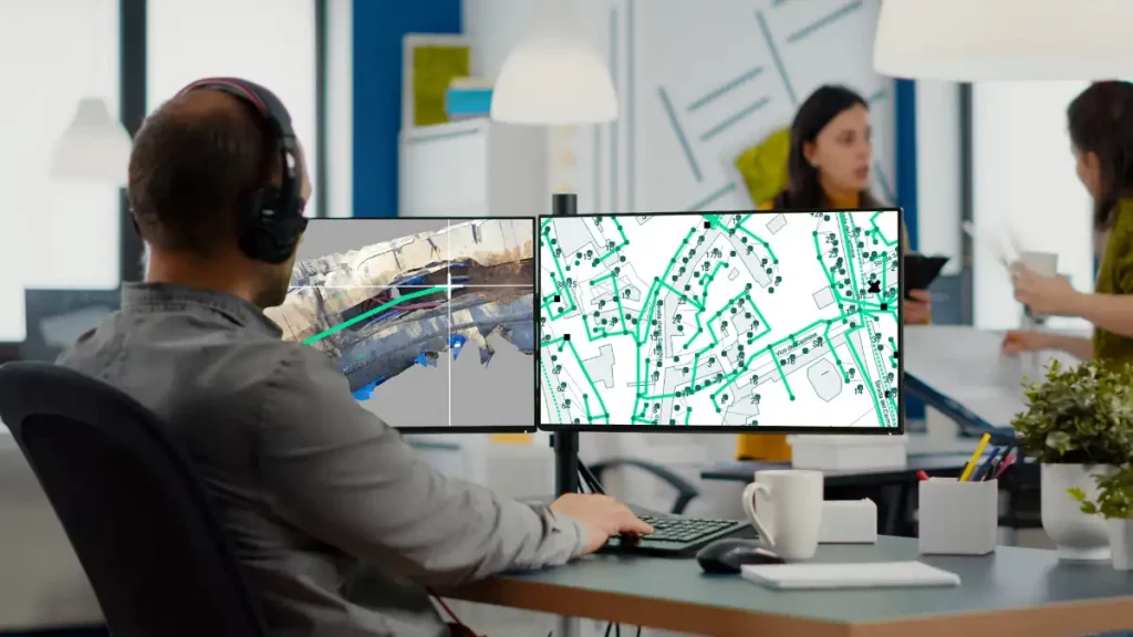
With 3D Photo Survey you can easily create 3D models of your networks. Discover how simple it is: all you need is a smartphone paired with a high-precision GPS!
These realistic, precise models —already georeferenced and oriented— have multiple uses. For example, from the comfort of your office, you can effortlessly map your networks in GIS. And this is just one of the applications made possible by this technology.