Categories
events

We are at Smart Water Summit 2024 – Madrid

With Terranova Software we are at the Smart Water Summit 2024, a leading event for the Spanish water sector with a focus on the most innovative solutions for digitising water management.

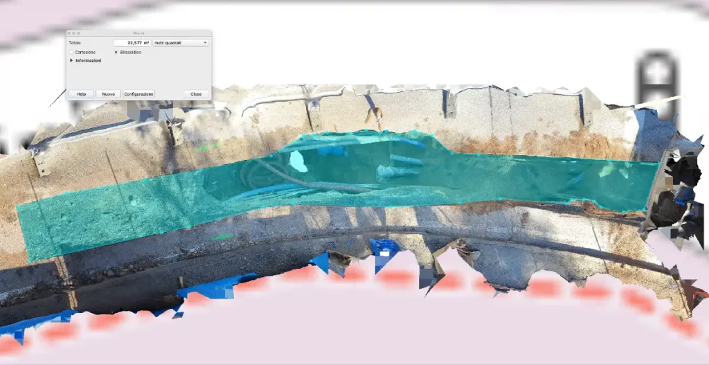
At the Meliá Hotel in Madrid we will be showing visitors all the benefits of Arcoda Next and our brand new 3D Photo Survey, the app that allows network distributors to carry out excavation site surveys directly with their smartphones and easily obtain precise three-dimensional models of excavations, already geo-referenced and oriented, ready for sharing or importing into their GIS.

Categories
products

3D Photo Survey: surveying is now done digitally

Welcome to the digital age of the utility excavation site!

If you work in a distribution utility and are in charge of managing excavation activities, you know how laborious on-site surveys are and how important precision is at this stage. Now, finally, you can change the way you work.

Find out how the 3D Photo Survey app can make surveying quick and easy, even to the point of entrusting it to field staff without any specific technical training! 

All you need is 3D Photo Survey and a smartphone paired with a GNSS RTK.

In just a few minutes on site you will obtain realistic 3D models, already georeferenced and oriented, on which you can carry out – in the present and in the future, when the excavation is closed – all measurements and analyses from the comfort of your office. A real mine of information, already in digital form, enabling new functions – also in augmented reality – for the digital transformation of your distribution utility.

Choose to save money and work better. 3D models of utility excavations and highly detailed orthophotos can now be obtained in minutes.

Categories
products

3D Photo Survey  to report restorations

3D Photo Survey is ideal for various uses in distribution network management. One key application is easily obtaining precise, objective measurements of road pavement rehabilitations after underground operations. These measurements are captured from the office by analyzing the high-accuracy 3D models acquired via 3D Photo Survey.

Choose a full digital process and speed up reporting, avoiding overestimates of restored surfaces! 
Do you need more info? Visit our website: