Categories
products

Excavation sites surveys: save time and money in the activities of verifying and final reporting of the work performed

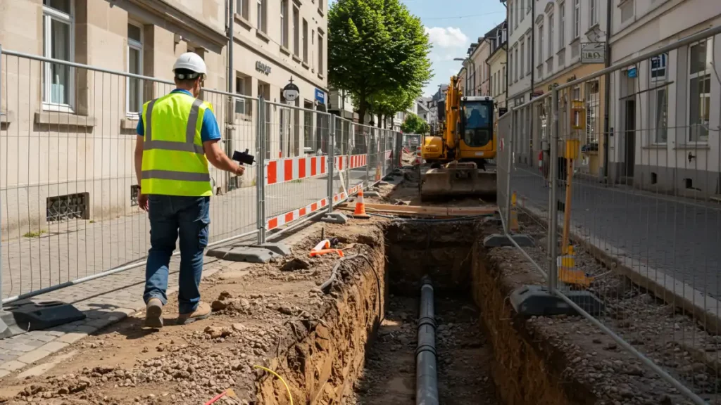
A digital revolution for excavation site surveys!

With our 3D Photo Survey app, utilities can conduct excavation surveys directly using a smartphone. With just a few minutes of survying on-site, the system generates precise, georeferenced, and oriented 3D models of network infrastructure.

The resulting models are standardized and compatible with the most widely used software or can be imported into your GIS, enabling easy reporting of completed work—even after excavations are backfilled—all without leaving the office!

If you want to reduce survey costs, speed up processes, and unlock new digital features for the future of your networks, choose the simplicity of 3D Photo Survey.

Categories
events

Visit us at the Water Festival 2024!

Florence

September 24-26, 2024

Come and visit Arcoda in Florence at the eighth edition of the Water Festival 2024! We will be at the event with Terranova Software, platinum sponsor of the event, and we will show our Arcoda Next app to support distribution networks field workers. You will also be able to discover the potential of 3D Photo Survey, the brand new Arcoda app that allows you to survey excavation sites completely digitally and directly with your smartphone. A real revolution for utilities that want to further digitize their field processes!

More about the event:

https://www.terranovasoftware.eu/eventi/festival-dell-acqua-2024

https://festivalacqua.org/

Categories
events

We are at Smart Water Summit 2024 – Madrid

With Terranova Software we are at the Smart Water Summit 2024, a leading event for the Spanish water sector with a focus on the most innovative solutions for digitising water management.

At the Meliá Hotel in Madrid we will be showing visitors all the benefits of Arcoda Next and our brand new 3D Photo Survey, the app that allows network distributors to carry out excavation site surveys directly with their smartphones and easily obtain precise three-dimensional models of excavations, already geo-referenced and oriented, ready for sharing or importing into their GIS.