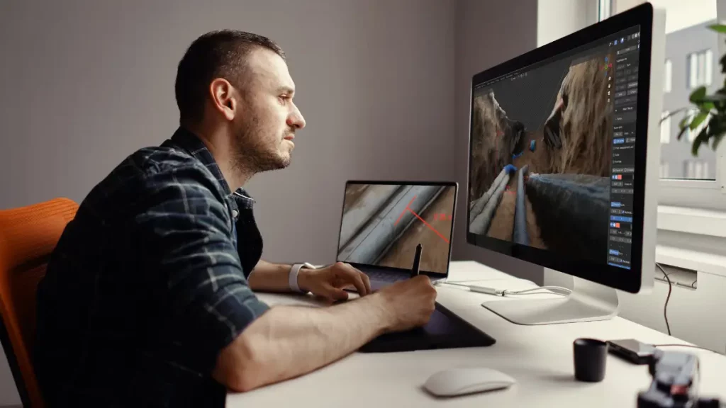
With 3D Photo Survey you can inspect network infrastructure without leaving the office. How? The 3D models of underground infrastructure captured via smartphone during utility excavation and installation phases are automatically uploaded to your corporate GIS. This allows back-office teams to work independently, eliminating the need for onsite personnel. From their desks, they can conduct virtual surveys, explore the network, and perform precision measurements directly on the digital models. Remote access to all geometric data is also ideal for digital work reporting!
Empower your back office, save time, reduce costs, and minimize fieldwork. Choose innovation with Arcoda Next.
Visit our website to find out more about the product and discover all the applications of 3D Photo Survey in network management: