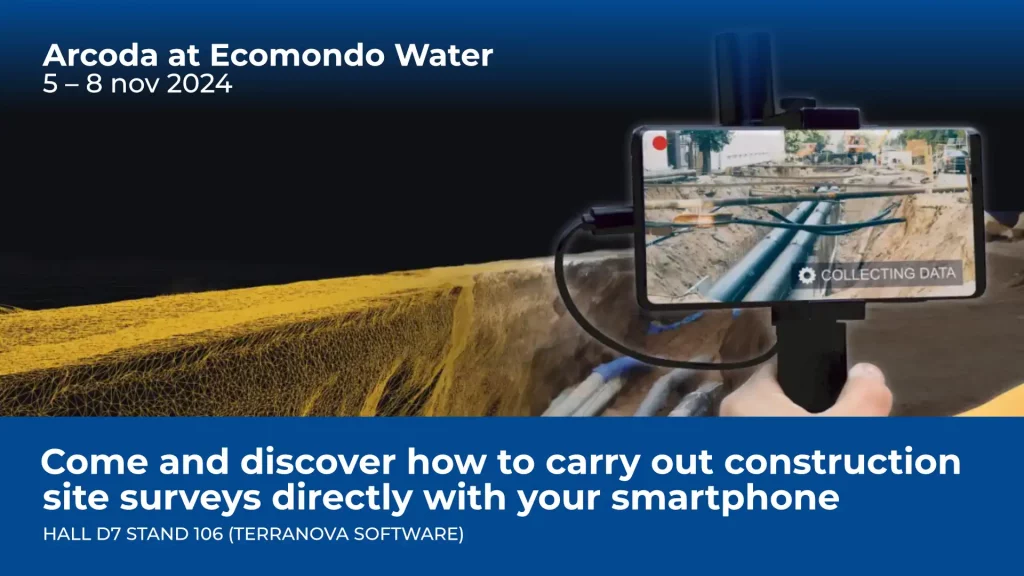
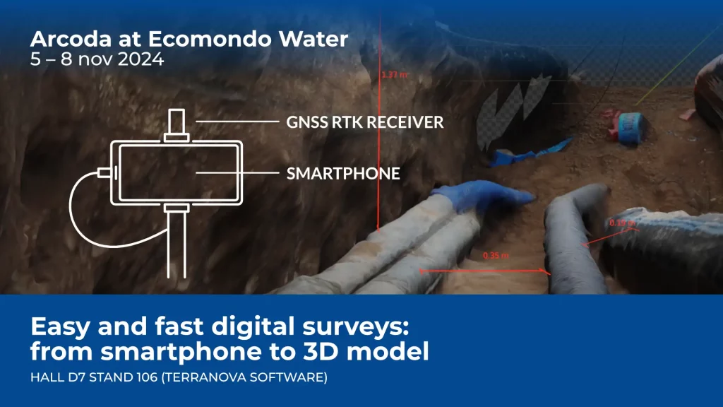
Categories
categoryless

Deval and Arcoda Next: the future of networks is digital

The 4,000 kilometres of electricity grid that Deval manages in the Aosta Valley tell the story of the people who work there every day.

24 hours a day, in summer and winter, this utility supplies electricity to homes, businesses and public services, in the valley floor as well as in the mountainous areas, in even the most remote ones. 

Next, the innovative Arcoda app adopted by Deval on its path of a continuous process of digitisation, brings into the hands of the technicians all the information support that field workers need to carry out interventions based on reliable, up-to-date and always available information. The management of distribution networks, in fact, is complex and requires reliable IT tools with the highest levels of performance, and Next – due to its innovative features and its ability to operate 100% independently of connectivity and server – fully meets these requirements.  

Categories
events

We are at Enlit Europe 2024 – Milan

We are at Enlit Europe 2024! Come visit us in Milan to discover 3D Photo Survey, the Arcoda app that allows you to survey digitally directly from your smartphone.

You will find us at two stands:

  • Gridspertise stand (stand 6.G70)
  • Pietro Fiorentini / Terranova stand (stand 6.B70)

What is 3D Photo Survey?

It is an app that, with just a few minutes on site, will allow you to carry out expeditious site surveys. In this way, those who manage the distribution network will easily have at their disposal precise and already georeferenced and oriented 3D models of underground utilities and excavations. In addition, the same app will allow you to obtain orthophotos with very high detail, without the need for aerial equipment.

Categories
products

With 3D Photo Survey you can quickly perform the mapping of your network infrastructure

For utilities, mapping network infrastructure is crucial, both for immediate purposes like reporting completed work and for future inspections.

With the 3D Photo Survey app, you can now conduct surveys at excavation sites quickly and easily, obtaining georeferenced and oriented 3D digital models of your network assets. These models also provide underground infrastructure mapping, allowing you to perform all current and future measurements you need directly from the office. Additionally, once the excavation is backfilled, you can accurately and effortlessly relocalise these assets whenever needed.

And this is just one of the many applications of 3D Photo Survey.

Discover how this app can revolutionize your work on distribution networks!