Categories
products

With Arcoda 3D Photo Survey, utility excavations become a goldmine of data!

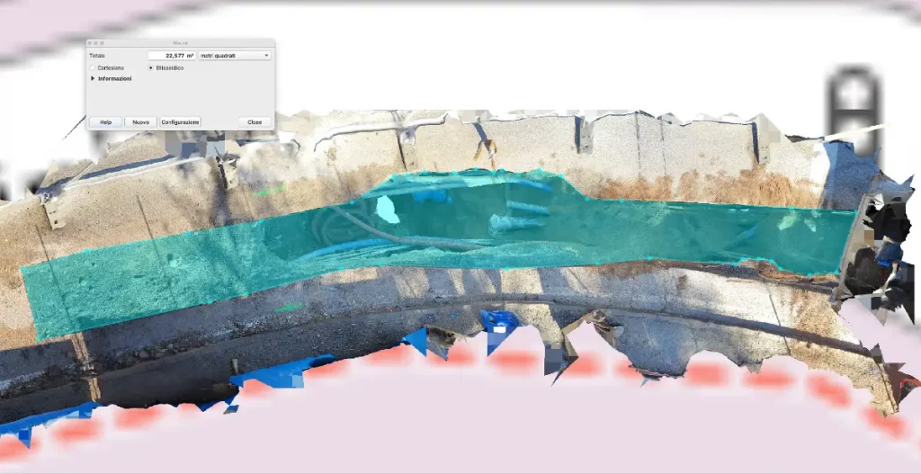
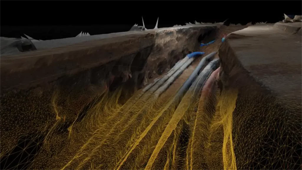
Thanks to 3D Photo Survey, network providers can perform expeditious excavation surveys using just a standard smartphone paired with an affordable, high-precision GPS device.

What do you get?

  • Precise, georeferenced 3D models of underground network infrastructure, automatically uploaded to your corporate GIS, ready for web visualization or CAD export.
  • Highly detailed orthophotos without the need for aerial equipment. Images are automatically added to your corporate GIS, ready for web visualization or CAD export.

With 3D Photo Survey, utility excavations become a strategic source of data that traditional surveys would lose. This makes it easy to develop a detailed and three-dimensional map of network infrastructure, accessible long-term even after excavations are closed!

Categories
events

We are at Servizi a rete Tour 2024 – Come and discover surveying with your smartphone

We are at Servizi a rete Tour 2024, the event dedicated to institutions, operators and technicians involved in network and underground utility management.

Come and visit us in Bari (Nicolaus Hotel), at the Pietro Fiorentini stand, and discover how easy it can be to carry out expeditious surveys of excavation sites directly with your smartphone. You will be able to obtain 3D models of your underground utilities and orthophotos in very high detail with just a few minutes on site, and enable numerous functions.

Categories
products

3D Photo Survey  to report restorations

3D Photo Survey is ideal for various uses in distribution network management. One key application is easily obtaining precise, objective measurements of road pavement rehabilitations after underground operations. These measurements are captured from the office by analyzing the high-accuracy 3D models acquired via 3D Photo Survey.

Choose a full digital process and speed up reporting, avoiding overestimates of restored surfaces! 
Do you need more info? Visit our website: